Canadian Wildfires Cause Poor Air Quality in Framingham
FRAMINGHAM, MA -- The U.S. Environmental Protection Agency (EPA) is alerting people in parts of Connecticut, Massachusetts, New Hampshire, Rhode Island, and Vermont regarding air quality that is unhealthy for sensitive groups, due to elevated concentrations of fine particle air pollution due to wildfires in Quebec and Northern Ontario.
Hazy skies, reduced visibility, and the odor of burning wood is very likely as the smoke plumes move through Framingham and the greater New England region.
The EPA warning recommends that "During the times that significant smoke is in your area, it is recommended that people with pre-existing medical conditions remain indoors with windows closed while circulating indoor air with a fan or air conditioner."
EPA and state forecasters are predicting that the smoke will linger in New England for a few days.
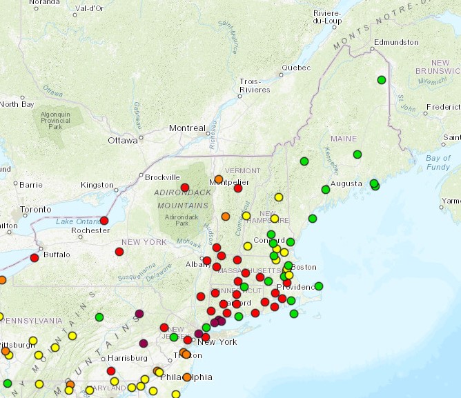
Locations are subject to change.
Exposure to elevated fine particle pollution levels can affect both your lungs and heart which may cause breathing problems, aggravate asthma, and other pre-existing lung diseases.
When particulate matter levels are elevated, people should refrain from strenuous outdoor activity, especially sensitive populations such as children and adults with respiratory problems.
Visit the EPA New England's AQI Air Quality Index web pages for current air quality conditions and forecasts across New England.
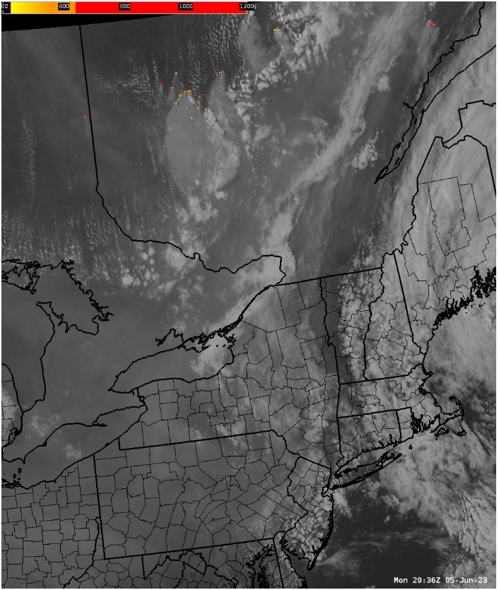
The U.S. National Weather Service reported on June 5, 2023, "Loads of smoke being produced by Canadian wildfires, affecting air quality." Screen capture (below) is from a satellite loop.
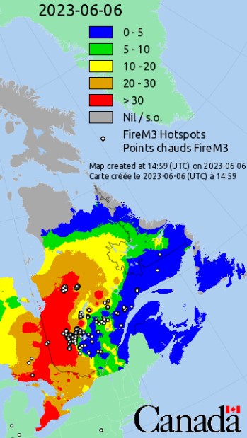
The next map (below) shows the Canadian governments official Wildland Fire Information System's Forest Fire Weather Index, a numeric rating of fire intensity. Hotspots (small white circles) in red areas of Quebec and Northern Ontario provinces are the cause of the smoky, poor quality air that has drifted south to through New Hampshire and Vermont and into Framingham, MA several times over the past few weeks.
Sources:
- EPA New England's AQI Air Quality Index: https://www3.epa.gov/region1/airquality/aqi.html
- Canadian Wildland Fire Information System: https://cwfis.cfs.nrcan.gc.ca/
- U.S. National Weather Service: https://www.weather.gov/
###